Geolocate

Monterrey topographic map

Click on the map to display elevation.

About this map

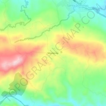
Name: Monterrey topographic map, elevation, terrain.

Location: Monterrey, San Carlos, Alajuela Province, 21012, Costa Rica (10.51593 -84.68019 10.55593 -84.64019)

Average elevation: 359 m

Minimum elevation: 235 m

Maximum elevation: 525 m

Gear up for your next adventure:

🥾Hiking Shorts - Breathable shorts suitable for summer hikes
🏃Hydration Running Vest - Carry water and maps close to your body for speed
🧦Merino Wool Socks - Moisture-wicking comfort for long-distance hiking
🩹Moleskin Blister Pads - Direct protection for painful foot pressure points
🔭Compact Monocular - One-handed bird watching and trail spotting

As an Amazon Associate, this site earns from qualifying purchases at no extra cost to you.