Geolocate

Maryapur topographic map

Click on the map to display elevation.

About this map

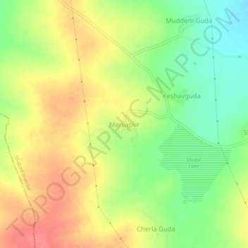
Name: Maryapur topographic map, elevation, terrain.

Location: Maryapur, Shabad mandal, Ranga Reddy, Telangana, 509217, India (17.14322 78.08967 17.18322 78.12967)

Average elevation: 644 m

Minimum elevation: 609 m

Maximum elevation: 676 m

Gear up for your next adventure:

🥾Hiking Boots - Sturdy boots providing ankle support and traction on rugged trails
🎒Hiking Daypack - Lightweight and durable backpacks for day trips and excursions
🧥Thermal Fleece Jacket - Versatile insulation for changing mountain temperatures
🔨Vehicle Emergency Tool - Safety tool for remote road trips to trailheads
Lightweight Camping Tent - Portable shelter optimized for Canadian backcountry camping

As an Amazon Associate, this site earns from qualifying purchases at no extra cost to you.