Geolocate

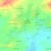
Senac topographic map

Click on the map to display elevation.

About this map

Name: Senac topographic map, elevation, terrain.

Location: Senac, Pipriac, Redon, Ille-et-Vilaine, Bretagne, France métropolitaine, 35550, France (47.78542 -1.90485 47.82542 -1.86485)

Average elevation: 50 m

Minimum elevation: 11 m

Maximum elevation: 92 m

Other topographic maps

Click on a map to view its topography, its elevation and its terrain.
35550

France > Bretagne > Ille-et-Vilaine > Pipriac > Le Bois Hulin

Average elevation: 52 m

Gear up for your next adventure:

☕Camping Coffee Maker - Brew fresh coffee anywhere on the topographic map
🥾Trail Hiking Shoes - Durable shoes designed for rugged trails
🛁Quick-Dry Microfiber Towel - Space-saving towel that dries rapidly on the move
🧴Insect Repellent - Protect yourself from bugs during outdoor adventures
🦶Anti-Blister Balm - Prevents friction and hotspots during long ascents

As an Amazon Associate, this site earns from qualifying purchases at no extra cost to you.