Geolocate

Hualla topographic map

Click on the map to display elevation.

About this map

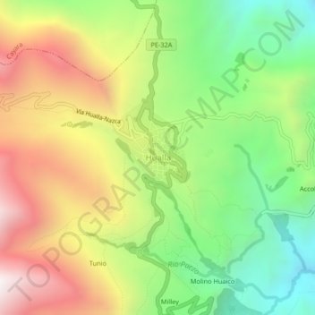
Name: Hualla topographic map, elevation, terrain.

Location: Hualla, Huaya, Víctor Fajardo, Ayacucho, Perú (-13.86984 -73.97087 -13.82984 -73.93087)

Average elevation: 3,396 m

Minimum elevation: 2,801 m

Maximum elevation: 4,124 m

Gear up for your next adventure:

👟Sport Hiking Sandals - Breathable footwear for water crossings and camp rest
🥾Mountaineering Boots - Supportive boots for climbing and high-altitude hiking
🥾Trail Running Boots - Durable shoes designed for trail running
🧥Softshell Hiking Jacket - The perfect balance of wind protection and breathability
🦌Outdoor Trail Camera - Monitor wildlife activity near your favorite spots

As an Amazon Associate, this site earns from qualifying purchases at no extra cost to you.