Geolocate

Almunia topographic map

Click on the map to display elevation.

About this map

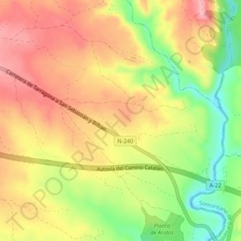
Name: Almunia topographic map, elevation, terrain.

Location: Almunia, Angüés, Hoya de Huesca, Huesca, Aragón, 22123, España (42.09129 -0.13245 42.11129 -0.11245)

Average elevation: 472 m

Minimum elevation: 394 m

Maximum elevation: 531 m

Gear up for your next adventure:

💧Hydration Bladder - Hands-free hydration solution for long treks
🚑Survival Whistle - Signal for help across long distances in mountains
Camping Tent - Weather-resistant tents suitable for 2 to 6 people
💧Filtered Water Bottle - Safe drinking water on the go
Camping Groundsheet - Protect your tent from moisture and dirt

As an Amazon Associate, this site earns from qualifying purchases at no extra cost to you.