Geolocate

Kansas City topographic map

Click on the map to display elevation.

About this map

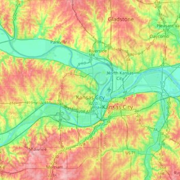
Name: Kansas City topographic map, elevation, terrain.

Location: Kansas City, Wyandotte County, Kansas, United States (39.04357 -94.90842 39.20301 -94.58820)

Average elevation: 268 m

Minimum elevation: 217 m

Maximum elevation: 333 m

Gear up for your next adventure:

Tent Footprint - Protect tent floor and increase durability
🛶Kayak Dry Bag - Waterproof storage for kayaking adventures
🧴Waterproofing Spray - Restore the DWR coating on jackets and tents
🦌Outdoor Trail Camera - Monitor wildlife activity near your favorite spots
🔥Camping Stove - Portable stoves to cook outdoors with ease

As an Amazon Associate, this site earns from qualifying purchases at no extra cost to you.