
Ward 1 topographic map
Click on the map to display elevation.
About this map
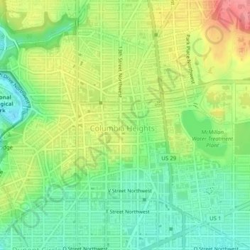
Name: Ward 1 topographic map, elevation, terrain.
Location: Ward 1, Washington, District of Columbia, United States (38.91382 -77.05086 38.93822 -77.01214)
Average elevation: 50 m
Minimum elevation: 14 m
Maximum elevation: 100 m
Other topographic maps
Click on a map to view its topography, its elevation and its terrain.
United States National Arboretum
United States > District of Columbia > Washington
Average elevation: 21 m
United States National Arboretum
United States > District of Columbia > Washington
Average elevation: 21 m