Geolocate

Chestnut Oaks topographic map

Click on the map to display elevation.

About this map

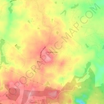
Name: Chestnut Oaks topographic map, elevation, terrain.

Location: Chestnut Oaks, Powhatan County, Virginia, United States (37.52098 -77.81222 37.56098 -77.77222)

Average elevation: 99 m

Minimum elevation: 28 m

Maximum elevation: 144 m

Gear up for your next adventure:

🔭Compact Binoculars - Lightweight optics for scouting trails and wildlife
💧Hydration Pack - Hands-free hydration system for long hikes
🥾Approach Boots - Comfortable boots for hiking and climbing approaches
🥾Waterproof Trail Shoes - Shoes designed to handle wet terrain
🧥Packable Rain Jacket - Breathable waterproof layer for unpredictable weather

As an Amazon Associate, this site earns from qualifying purchases at no extra cost to you.