Geolocate

Montret topographic map

Click on the map to display elevation.

About this map
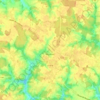
Name: Montret topographic map, elevation, terrain.

Location: Montret, Louhans, Saône-et-Loire, Bourgogne-Franche-Comté, Metropolitan France, 71440, France (46.65491 5.08495 46.71004 5.14962)

Average elevation: 203 m

Minimum elevation: 183 m

Maximum elevation: 214 m

Other topographic maps

Click on a map to view its topography, its elevation and its terrain.
Lavaux

France > Bourgogne-Franche-Comté > Saône-et-Loire > Dyo > Lavaux

Average elevation: 332 m

Gear up for your next adventure:

🧳Compression Sacks - Maximize space in your backpack by shrinking gear
⛺Lightweight Camping Tent - Portable shelter optimized for Canadian backcountry camping
🔥Camping Stove - Portable stoves to cook outdoors with ease
💡LED Headlamp - Hands-free illumination for night hiking and camping
🪑Ultralight Camping Stool - Compact seating for rest stops during long hikes

As an Amazon Associate, this site earns from qualifying purchases at no extra cost to you.