Geolocate

Graden topographic map

Click on the map to display elevation.

About this map

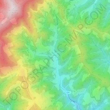
Name: Graden topographic map, elevation, terrain.

Location: Graden, Köflach, Bezirk Voitsberg, Styria, 8580, Austria (47.11207 15.01449 47.15207 15.05449)

Average elevation: 894 m

Minimum elevation: 603 m

Maximum elevation: 1,352 m

Gear up for your next adventure:

🍽️Titanium Camping Spork - Ultralight and indestructible eating utensil
🚲Heavy Duty Bike Lock - Secure your bike at the trailhead or during stops
🥘Camping Cookware Set - Compact nesting pots and pans for trail cooking
🧥Packable Rain Jacket - Breathable waterproof layer for unpredictable weather
🔦UV Flashlight - Detect minerals or specific insects in the dark

As an Amazon Associate, this site earns from qualifying purchases at no extra cost to you.