Geolocate

Gukeng topographic map

Click on the map to display elevation.

About this map

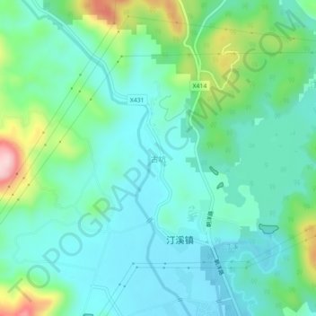
Name: Gukeng topographic map, elevation, terrain.

Location: Gukeng, Tong'an District, Xiamen, Fujian, China (24.78158 118.10187 24.82158 118.14187)

Average elevation: 91 m

Minimum elevation: 24 m

Maximum elevation: 306 m

Gear up for your next adventure:

🧤Thermal Hiking Gloves - Grip-enhanced gloves for cold-weather altitude trekking
🧦Crew Hiking Socks - Comfortable socks for long-distance hikes
🧣Merino Neck Gaiter - Protects against wind, sun, and cold at high altitudes
💡Portable Camping Lamp - Rechargeable lamp for campsite lighting
🥽Outdoor Goggles - Protective eyewear for outdoor activities

As an Amazon Associate, this site earns from qualifying purchases at no extra cost to you.