Geolocate

Covadonga topographic map

Click on the map to display elevation.

About this map
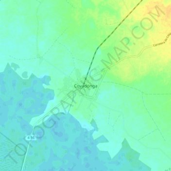
Name: Covadonga topographic map, elevation, terrain.

Location: Covadonga, Aguada de Pasajeros, Cienfuegos, Cuba (22.22946 -80.90822 22.30946 -80.82822)

Average elevation: 9 m

Minimum elevation: 2 m

Maximum elevation: 26 m

Other topographic maps

Click on a map to view its topography, its elevation and its terrain.
Cienfuegos

Cuba > Cienfuegos

Average elevation: 22 m

Cienfuegos

Cuba > Cienfuegos

Average elevation: 22 m

Gear up for your next adventure:

🔋Solar Power Bank - Keep your GPS and devices charged during long outdoor trips
🥾All-Terrain Hiking Boots - Versatile boots for varied hiking conditions
❄️Traction Ice Cleats - Slip-on spikes for icy trails and winter hiking
🧦Merino Wool Socks - Moisture-wicking comfort for long-distance hiking
💧Hydration Bladder - Hands-free hydration solution for long treks

As an Amazon Associate, this site earns from qualifying purchases at no extra cost to you.