
Tapri topographic map
Interactive map
Click on the map to display elevation.
About this map
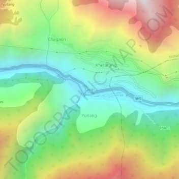
Name: Tapri topographic map, elevation, terrain.
Average elevation: 2,312 m
Minimum elevation: 1,643 m
Maximum elevation: 3,369 m
Other topographic maps
Click on a map to view its topography, its elevation and its terrain.
Karcham Wangtoo Hydroelectric Project
Inde > Himachal Pradesh > Nichar > Joktarang
Karcham Wangtoo Hydroelectric Project, Joktarang, Nichar, Kinnaur District, Himachal Pradesh, 172103, Inde
Average elevation: 1,929 m