
Thank you for supporting this site ❤️
Make a donation
Make a donation
Gear up for your next adventure:
As an Amazon Associate, this site earns from qualifying purchases at no extra cost to you.
Manjhladih topographic map
Click on the map to display elevation.
Thank you for supporting this site ❤️
Make a donation
Make a donation
Gear up for your next adventure:
As an Amazon Associate, this site earns from qualifying purchases at no extra cost to you.
About this map
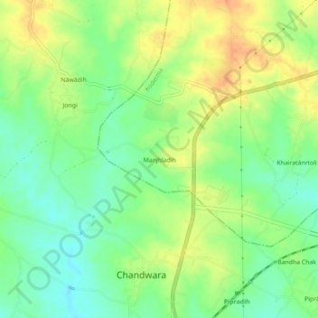
Name: Manjhladih topographic map, elevation, terrain.
Location: Manjhladih, Koderma, Kodarma District, Jharkhand, India (24.38751 85.46228 24.42751 85.50228)
Average elevation: 382 m
Minimum elevation: 363 m
Maximum elevation: 404 m
Thank you for supporting this site ❤️
Make a donation
Make a donation
Gear up for your next adventure:
As an Amazon Associate, this site earns from qualifying purchases at no extra cost to you.