Geolocate

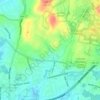
Cochituate topographic map

Click on the map to display elevation.

About this map

Name: Cochituate topographic map, elevation, terrain.

Location: Cochituate, Wayland, Middlesex County, Massachusetts, United States (42.30982 -71.38180 42.35002 -71.32841)

Average elevation: 61 m

Minimum elevation: 32 m

Maximum elevation: 121 m

Other topographic maps

Click on a map to view its topography, its elevation and its terrain.
Gear up for your next adventure:

🥾Hiking Leggings - Comfortable leggings for outdoor activities
🕶️Polarized Sunglasses - Reduces glare from snow and water at high elevations
🥾Durable Hiking Shoes - Long-lasting shoes for frequent hiking
👟Sport Hiking Sandals - Breathable footwear for water crossings and camp rest
🧥Thermal Fleece Jacket - Versatile insulation for changing mountain temperatures

As an Amazon Associate, this site earns from qualifying purchases at no extra cost to you.