Geolocate

The Oaks topographic map

Click on the map to display elevation.

About this map
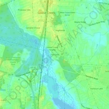
Name: The Oaks topographic map, elevation, terrain.

Location: The Oaks, Goose Creek, Berkeley County, South Carolina, 29445, United States (32.96073 -80.05509 33.00073 -80.01509)

Average elevation: 8 m

Minimum elevation: -4 m

Maximum elevation: 15 m

Other topographic maps

Click on a map to view its topography, its elevation and its terrain.

Gear up for your next adventure:

🥾Trekking Poles - Adjustable trekking poles to reduce knee stress and improve stability
💡LED Camping Lantern - Illuminate your campsite with long-lasting lanterns
🧥Thermal Layer - Insulating layer for cold outdoor conditions
🛁Quick-Dry Microfiber Towel - Space-saving towel that dries rapidly on the move
🚑Survival Whistle - Signal for help across long distances in mountains

As an Amazon Associate, this site earns from qualifying purchases at no extra cost to you.