Geolocate

chhana topographic map

Click on the map to display elevation.

About this map

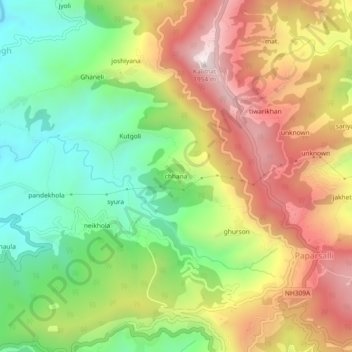
Name: chhana topographic map, elevation, terrain.

Location: chhana, Almora, Almora District, Uttarakhand, 263600, India (29.60952 79.63752 29.64952 79.67752)

Average elevation: 1,517 m

Minimum elevation: 1,155 m

Maximum elevation: 1,945 m

Gear up for your next adventure:

🧴Bear Spray Holster - Quick-access carry for essential Canadian wilderness safety
🥾Mountaineering Boots - Supportive boots for climbing and high-altitude hiking
🛰️Satellite Messenger - Emergency communication for areas with no cell service
🧥Softshell Hiking Jacket - The perfect balance of wind protection and breathability
🎒Backpack Rain Cover - External shield to keep your entire pack dry

As an Amazon Associate, this site earns from qualifying purchases at no extra cost to you.