Geolocate

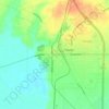
Wilderville topographic map

Click on the map to display elevation.

About this map

Name: Wilderville topographic map, elevation, terrain.

Location: Wilderville, Falls County, Texas, United States (31.08463 -96.90304 31.12463 -96.86304)

Average elevation: 127 m

Minimum elevation: 114 m

Maximum elevation: 139 m

Other topographic maps

Click on a map to view its topography, its elevation and its terrain.
Marlin

United States > Texas > Falls County

Average elevation: 119 m

Bone Branch

United States > Texas > Falls County

Average elevation: 147 m

Rosebud

United States > Texas > Falls County

Average elevation: 124 m

Marlin

United States > Texas > Falls County

Average elevation: 119 m

Marlin

United States > Texas > Falls County

Average elevation: 119 m

Gear up for your next adventure:

🧴First Aid Kit - Essential first aid supplies for outdoor emergencies
🧥Thermal Fleece Jacket - Versatile insulation for changing mountain temperatures
🧭Orienteering Kit - Tools for map reading and navigation in the wild
🔭Outdoor Binoculars - Lightweight binoculars for birdwatching and hiking
🕶️Polarized Sunglasses - Protect your eyes with durable polarized lenses

As an Amazon Associate, this site earns from qualifying purchases at no extra cost to you.