Geolocate

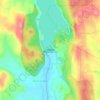
Manchanabele topographic map

Click on the map to display elevation.

About this map

Name: Manchanabele topographic map, elevation, terrain.

Location: Manchanabele, Magadi taluku, Bengaluru South, Karnataka, 561201, India (12.84689 77.31442 12.88689 77.35442)

Average elevation: 773 m

Minimum elevation: 707 m

Maximum elevation: 867 m

Other topographic maps

Click on a map to view its topography, its elevation and its terrain.
Manchanabele

India > Karnataka > Magadi taluku

Average elevation: 771 m

Gear up for your next adventure:

🔨Vehicle Emergency Tool - Safety tool for remote road trips to trailheads
🥾Hiking Gaiters - Protect legs and shoes from mud, snow, and debris
🧊Insulated Water Bottle - Keeps drinks cold in summer and prevents freezing in winter
⛺Camping Tent - Weather-resistant tents suitable for 2 to 6 people
🕯️Camping Lantern - Illuminates your entire campsite with high-efficiency LEDs

As an Amazon Associate, this site earns from qualifying purchases at no extra cost to you.