Geolocate

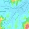
Egito topographic map

Click on the map to display elevation.

About this map

Name: Egito topographic map, elevation, terrain.

Location: Egito, Antônio Carlos, Santa Catarina, Região Sul, Brasil (-27.55703 -48.92346 -27.51255 -48.86559)

Average elevation: 476 m

Minimum elevation: 98 m

Maximum elevation: 885 m

Other topographic maps

Click on a map to view its topography, its elevation and its terrain.
Rio Canudos

Brasil > Santa Catarina > Antônio Carlos

Average elevation: 37 m

Gear up for your next adventure:

🔥Camping Stove - Portable stoves to cook outdoors with ease
🧥Insulated Jacket - Keep warm in cold outdoor conditions
🦶Anti-Blister Balm - Prevents friction and hotspots during long ascents
🔨Vehicle Emergency Tool - Safety tool for remote road trips to trailheads
🧦Crew Hiking Socks - Comfortable socks for long-distance hikes

As an Amazon Associate, this site earns from qualifying purchases at no extra cost to you.