Geolocate

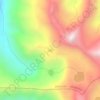
Mukta Top topographic map

Click on the map to display elevation.

About this map

Name: Mukta Top topographic map, elevation, terrain.

Location: Mukta Top, Bhatwari, Uttarkashi, Uttarakhand, India (30.81597 78.52428 30.81607 78.52438)

Average elevation: 3,141 m

Minimum elevation: 2,500 m

Maximum elevation: 3,761 m

Other topographic maps

Click on a map to view its topography, its elevation and its terrain.
Harsil

India > Uttarakhand > Bhatwari

Average elevation: 2,761 m

Kyarkoti Lake

India > Uttarakhand > Bhatwari

Average elevation: 4,043 m

Pari Maatri Taal

India > Uttarakhand > Bhatwari

Average elevation: 4,443 m

Kedar Tal

India > Uttarakhand > Bhatwari

Average elevation: 4,814 m

Pulam Sumda

India > Uttarakhand > Bhatwari

Average elevation: 4,571 m

Gangotri Glacier

India > Uttarakhand > Bhatwari

Average elevation: 5,259 m

Dayara Bugyal

India > Uttarakhand > Bhatwari

Average elevation: 3,451 m

Gangotri Glacier

India > Uttarakhand > Bhatwari

Average elevation: 5,259 m

Kedar Tal

India > Uttarakhand > Bhatwari

Average elevation: 4,814 m

Kalindi Khal Area

India > Uttarakhand > Bhatwari

Average elevation: 5,857 m

Harsil

India > Uttarakhand > Bhatwari

Average elevation: 2,761 m

Gear up for your next adventure:

🛏️Camping Sleeping Mat - Comfortable mats for sleeping outdoors
🧥Softshell Hiking Jacket - The perfect balance of wind protection and breathability
👖Convertible Hiking Pants - Zip-off legs to adapt to changing weather conditions
🔦LED Headlamp - Hands-free lighting for early morning starts or late finishes
🥾Trail Hiking Shoes - Durable shoes designed for rugged trails

As an Amazon Associate, this site earns from qualifying purchases at no extra cost to you.