Geolocate

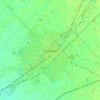
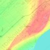
Erie Beach topographic map

Click on the map to display elevation.

About this map

Name: Erie Beach topographic map, elevation, terrain.

Location: Erie Beach, Chatham-Kent, Southwestern Ontario, Ontario, N0P 1E0, Canada (42.24557 -82.02863 42.28557 -81.98863)

Average elevation: 179 m

Minimum elevation: 170 m

Maximum elevation: 207 m

Other topographic maps

Click on a map to view its topography, its elevation and its terrain.
Bothwell

Canada > Ontario > Chatham-Kent

Average elevation: 207 m

Thamesville

Canada > Ontario > Chatham-Kent

Average elevation: 188 m

Chatham

Canada > Ontario > Chatham-Kent

Average elevation: 182 m

Blythe Park

Canada > Ontario > Chatham-Kent > Chatham

Average elevation: 182 m

Harwich

Canada > Ontario > Chatham-Kent > Chatham

Average elevation: 189 m

Howard

Canada > Ontario > Chatham-Kent > Morpeth

Average elevation: 198 m

Chatham

Canada > Ontario > Chatham-Kent

In 1790, pioneer surveyor Patrick McNiff departed from Lake St. Clair and travelled upstream along the Thames River to survey the lands that would, in 1792, become Kent County. During this voyage, McNiff found that some 28 families had already established themselves in the region, suggesting the date of the…

Average elevation: 182 m

Chatham

Canada > Ontario > Chatham-Kent

Average elevation: 182 m

Gear up for your next adventure:

🔪Outdoor Multitool - Versatile tool for repairs and food prep in the wild
🪑Insulated Seat Pad - Protect your seat from cold rocks and wet logs
👟Leg Gaiters - Keep debris, mud, and snow out of your boots
🧴First Aid Kit - Essential first aid supplies for outdoor emergencies
🧣Merino Neck Gaiter - Protects against wind, sun, and cold at high altitudes

As an Amazon Associate, this site earns from qualifying purchases at no extra cost to you.