Geolocate

Feilding topographic map

Click on the map to display elevation.

About this map
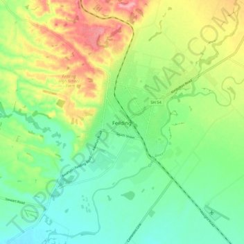
Name: Feilding topographic map, elevation, terrain.

Location: Feilding, Manawatū District, Manawatū-Whanganui, 4702, New Zealand (-40.26628 175.52444 -40.18628 175.60444)

Average elevation: 84 m

Minimum elevation: 41 m

Maximum elevation: 158 m

Other topographic maps

Click on a map to view its topography, its elevation and its terrain.

Gear up for your next adventure:

🥾Trail Hiking Shoes - Durable shoes designed for rugged trails
🔦LED Flashlight - Powerful and long-lasting flashlight for camping and emergencies
🥾Approach Shoes - Shoes designed for climbing approaches and rugged trails
🔪Outdoor Multitool - Versatile tool for repairs and food prep in the wild
🛌Down Sleeping Bag - Superior warmth-to-weight ratio for cold nights

As an Amazon Associate, this site earns from qualifying purchases at no extra cost to you.