Geolocate

Bigfork topographic map

Click on the map to display elevation.

About this map
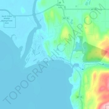
Name: Bigfork topographic map, elevation, terrain.

Location: Bigfork, Flathead County, Montana, United States (48.03681 -114.12811 48.09925 -114.02895)

Average elevation: 922 m

Minimum elevation: 879 m

Maximum elevation: 1,187 m

Gear up for your next adventure:

🪑Insulated Seat Pad - Protect your seat from cold rocks and wet logs
🧭Orienteering Kit - Tools for map reading and navigation in the wild
🧤Insulated Winter Gloves - Heavy-duty protection for sub-zero Canadian adventures
💧Filtered Water Bottle - Safe drinking water on the go
⛺Camping Essentials - All-in-one gear for a comfortable camping trip

As an Amazon Associate, this site earns from qualifying purchases at no extra cost to you.