Geolocate

Mulshi topographic map

Click on the map to display elevation.

About this map
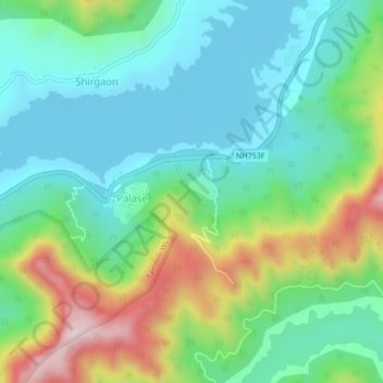
Name: Mulshi topographic map, elevation, terrain.

Location: Mulshi, Mulshi Subdistrict, Pune District, Maharashtra, India (18.48002 73.49374 18.52002 73.53374)

Average elevation: 689 m

Minimum elevation: 585 m

Maximum elevation: 1,146 m

Other topographic maps

Click on a map to view its topography, its elevation and its terrain.

Temghar dam

India > Maharashtra > Mulshi Subdistrict

Average elevation: 745 m

Mulshi Dam

India > Maharashtra > Mulshi Subdistrict > Sambhave

Average elevation: 608 m

Shirgaon

India > Maharashtra > Mulshi Subdistrict

Average elevation: 688 m

Gear up for your next adventure:

🧤Thermal Hiking Gloves - Grip-enhanced gloves for cold-weather altitude trekking
🧶550 Survival Paracord - Versatile utility cord for emergency repairs and rigging
⛺Lightweight Camping Tent - Portable shelter optimized for Canadian backcountry camping
🧥Packable Rain Jacket - Breathable waterproof layer for unpredictable weather
🔦LED Headlamp - Hands-free lighting for early morning starts or late finishes

As an Amazon Associate, this site earns from qualifying purchases at no extra cost to you.