Geolocate

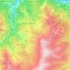
Le Chalmieu topographic map

Click on the map to display elevation.

About this map

Name: Le Chalmieu topographic map, elevation, terrain.

Location: Le Chalmieu, Montrond, Albiez-Montrond, Saint-Jean-de-Maurienne, Savoie, Auvergne-Rhône-Alpes, France métropolitaine, 73300, France (45.16556 6.29699 45.20556 6.33699)

Average elevation: 1,695 m

Minimum elevation: 1,074 m

Maximum elevation: 2,493 m

Other topographic maps

Click on a map to view its topography, its elevation and its terrain.
Montrond

France > Auvergne-Rhône-Alpes > Savoie > Albiez-Montrond

Average elevation: 2,048 m

Gear up for your next adventure:

🧰Survival Kit - Essential gear for emergencies in the wilderness
🚲Bike Repair Kit - Essential tools for on-trail mechanical issues
🧥Thermal Fleece Jacket - Versatile insulation for changing mountain temperatures
🧭GPS Outdoor Watch - Smart watch for navigation and fitness tracking in nature
🧦Crew Hiking Socks - Comfortable socks for long-distance hikes

As an Amazon Associate, this site earns from qualifying purchases at no extra cost to you.