Geolocate

Subdega topographic map

Click on the map to display elevation.

About this map

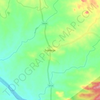
Name: Subdega topographic map, elevation, terrain.

Location: Subdega, Talasara, Sundargarh District, Odisha, 770014, India (22.25246 84.06567 22.33246 84.14567)

Average elevation: 276 m

Minimum elevation: 239 m

Maximum elevation: 357 m

Gear up for your next adventure:

Tent Footprint - Protect tent floor and increase durability
🧦Hiking Liner Socks - Thin base layer to prevent friction and blisters
🚑Survival Whistle - Signal for help across long distances in mountains
🦶Hiking Shoe Insoles - Added support for high arches and long days on feet
🛁Quick-Dry Microfiber Towel - Space-saving towel that dries rapidly on the move

As an Amazon Associate, this site earns from qualifying purchases at no extra cost to you.