Geolocate

Itlugan topographic map

Click on the map to display elevation.

About this map

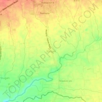
Name: Itlugan topographic map, elevation, terrain.

Location: Itlugan, Rosario, Batangas, Calabarzon, 4225, Philippines (13.80326 121.18628 13.84326 121.22628)

Average elevation: 126 m

Minimum elevation: 93 m

Maximum elevation: 149 m

Other topographic maps

Click on a map to view its topography, its elevation and its terrain.

Pinagsibaan

Philippines > Batangas > Rosario

Average elevation: 57 m

Gear up for your next adventure:

🔦LED Headlamp - Hands-free lighting for early morning starts or late finishes
🥾Trail Running Boots - Durable shoes designed for trail running
🥾Trail Running Shoes - Lightweight and durable shoes for trail running
🧥Softshell Hiking Jacket - The perfect balance of wind protection and breathability
🥾Approach Boots - Comfortable boots for hiking and climbing approaches

As an Amazon Associate, this site earns from qualifying purchases at no extra cost to you.