Geolocate

Ampfield topographic map

Click on the map to display elevation.

About this map

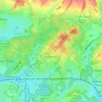
Name: Ampfield topographic map, elevation, terrain.

Location: Ampfield, Test Valley, Hampshire, England, United Kingdom (50.99422 -1.46553 51.02559 -1.39194)

Average elevation: 51 m

Minimum elevation: 24 m

Maximum elevation: 102 m

Other topographic maps

Click on a map to view its topography, its elevation and its terrain.

Gear up for your next adventure:

🥾Trail Hiking Boots - Supportive boots for rough trails
🔥Emergency Fire Starter - Reliable ignition source for all weather conditions
Camping Tent - Weather-resistant tents suitable for 2 to 6 people
🩹Compact First Aid Kit - Pre-packed essentials for common trail injuries
🧦Crew Hiking Socks - Comfortable socks for long-distance hikes

As an Amazon Associate, this site earns from qualifying purchases at no extra cost to you.