Geolocate

Alamin topographic map

Click on the map to display elevation.

About this map

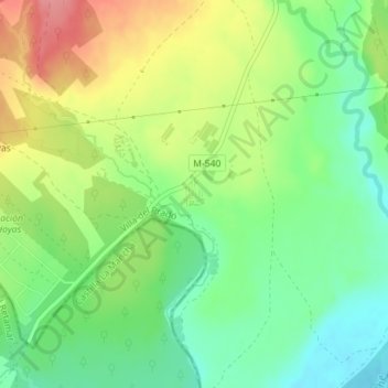
Name: Alamin topographic map, elevation, terrain.

Location: Alamin, Villa del Prado, Community of Madrid, 28630, Spain (40.22584 -4.31697 40.24584 -4.29697)

Average elevation: 472 m

Minimum elevation: 433 m

Maximum elevation: 527 m

Gear up for your next adventure:

👖Convertible Hiking Pants - Zip-off legs to adapt to changing weather conditions
🥾Trail Hiking Socks - Comfortable socks to prevent blisters and fatigue
💡Solar Camping Lamp - Eco-friendly lighting for campsites
🧢Sun Hat - Wide-brim hat for sun protection
🥾Mountain Hiking Shoes - Shoes with superior grip for mountainous terrain

As an Amazon Associate, this site earns from qualifying purchases at no extra cost to you.