
Puybelliard topographic map
Click on the map to display elevation.
About this map
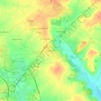
Name: Puybelliard topographic map, elevation, terrain.
Average elevation: 70 m
Minimum elevation: 44 m
Maximum elevation: 91 m
Other topographic maps
Click on a map to view its topography, its elevation and its terrain.
Saint-Philbert-du-Pont-Charrault
France > Pays de la Loire > Vendée > Chantonnay
Average elevation: 79 m
L'Angle Guignard
France > Pays de la Loire > Vendée > Chantonnay > L'Assemblée
Average elevation: 63 m