
Thank you for supporting this site ❤️
Make a donation
Make a donation
Gear up for your next adventure:
As an Amazon Associate, this site earns from qualifying purchases at no extra cost to you.
Tabourt topographic map
Click on the map to display elevation.
Thank you for supporting this site ❤️
Make a donation
Make a donation
Gear up for your next adventure:
As an Amazon Associate, this site earns from qualifying purchases at no extra cost to you.
About this map
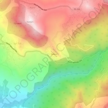
Name: Tabourt topographic map, elevation, terrain.
Location: Tabourt, Ifigha, Daïra Azazga, Tizi Ouzou, Algérie (36.64009 4.42277 36.68009 4.46277)
Average elevation: 615 m
Minimum elevation: 248 m
Maximum elevation: 973 m
Thank you for supporting this site ❤️
Make a donation
Make a donation
Gear up for your next adventure:
As an Amazon Associate, this site earns from qualifying purchases at no extra cost to you.