Geolocate

Jati topographic map

Click on the map to display elevation.

About this map

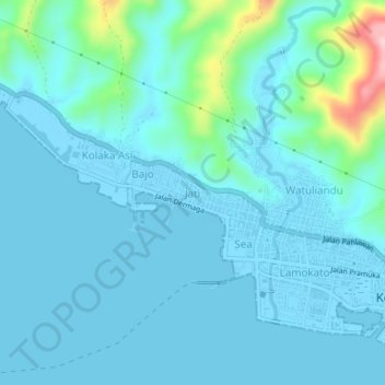
Name: Jati topographic map, elevation, terrain.

Location: Jati, Kolaka, Southeast Sulawesi, Sulawesi, Indonesia (-4.06880 121.56440 -4.02880 121.60440)

Average elevation: 28 m

Minimum elevation: -5 m

Maximum elevation: 226 m

Gear up for your next adventure:

🧥Softshell Hiking Jacket - The perfect balance of wind protection and breathability
🧦Crew Hiking Socks - Comfortable socks for long-distance hikes
🕶️Polarized Sunglasses - Protect your eyes with durable polarized lenses
🧥Fleece Jacket - Warm and lightweight jacket for layering
🧣Evaporative Cooling Towel - Beat the heat during intense summer climbs

As an Amazon Associate, this site earns from qualifying purchases at no extra cost to you.