Geolocate

Dashan topographic map

Click on the map to display elevation.

About this map

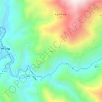
Name: Dashan topographic map, elevation, terrain.

Location: Dashan, Longsheng, Guilin, Guangxi, China (25.71432 110.06645 25.75432 110.10645)

Average elevation: 569 m

Minimum elevation: 258 m

Maximum elevation: 1,160 m

Gear up for your next adventure:

🪑Insulated Seat Pad - Protect your seat from cold rocks and wet logs
👟Leg Gaiters - Keep debris, mud, and snow out of your boots
🔦LED Headlamp - Hands-free lighting for early morning starts or late finishes
🛶Kayak Dry Bag - Waterproof storage for kayaking adventures
Camping Essentials - All-in-one gear for a comfortable camping trip

As an Amazon Associate, this site earns from qualifying purchases at no extra cost to you.