Geolocate

Pamona topographic map

Click on the map to display elevation.

About this map
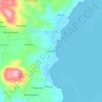
Name: Pamona topographic map, elevation, terrain.

Location: Pamona, Batusendi, Gresik, East Java, Java, Indonesia (-5.82856 112.70834 -5.78856 112.74834)

Average elevation: 45 m

Minimum elevation: 0 m

Maximum elevation: 242 m

Gear up for your next adventure:

🔦LED Headlamp - Hands-free lighting for early morning starts or late finishes
🪜Heavy Duty Carabiners - Multi-use clips for securing gear to your backpack
⛺Tent Footprint - Protect tent floor and increase durability
🦟Insect Repellent - Keep mosquitoes and black flies away in wooded areas
🕶️Polarized Sunglasses - Protect your eyes with durable polarized lenses

As an Amazon Associate, this site earns from qualifying purchases at no extra cost to you.