Geolocate

Kebonan topographic map

Click on the map to display elevation.

About this map

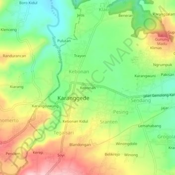
Name: Kebonan topographic map, elevation, terrain.

Location: Kebonan, Karanggede, Boyolali, Central Java, Java, Indonesia (-7.38174 110.62260 -7.34174 110.66260)

Average elevation: 300 m

Minimum elevation: 217 m

Maximum elevation: 405 m

Gear up for your next adventure:

🎒Backpack Rain Cover - External shield to keep your entire pack dry
💧Hydration Bladder - Hands-free hydration solution for long treks
🥾Trail Hiking Socks - Comfortable socks to prevent blisters and fatigue
🥾All-Terrain Hiking Boots - Versatile boots for varied hiking conditions
💡Compact LED Flashlight - Powerful and portable flashlight for outdoor use

As an Amazon Associate, this site earns from qualifying purchases at no extra cost to you.