Geolocate

Fritzlar topographic map

Click on the map to display elevation.

About this map
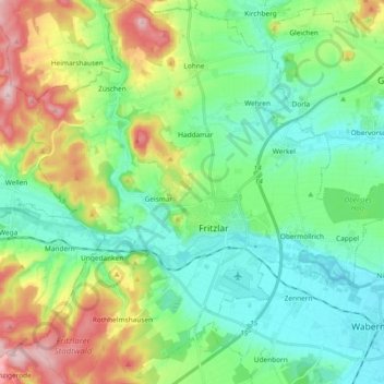
Name: Fritzlar topographic map, elevation, terrain.

Location: Fritzlar, Schwalm-Eder-Kreis, Hesse, 34560, Germany (51.08369 9.18667 51.20051 9.36912)

Average elevation: 237 m

Minimum elevation: 160 m

Maximum elevation: 416 m

Gear up for your next adventure:

⛺Family Camping Tent - Spacious tent suitable for family camping trips
🧥Fleece Jacket - Warm and lightweight jacket for layering
🧥Softshell Hiking Jacket - The perfect balance of wind protection and breathability
🥾Hiking Boots - Sturdy boots providing ankle support and traction on rugged trails
⛺Lightweight Camping Tent - Portable shelter optimized for Canadian backcountry camping

As an Amazon Associate, this site earns from qualifying purchases at no extra cost to you.