Geolocate

Roy topographic map

Click on the map to display elevation.

About this map

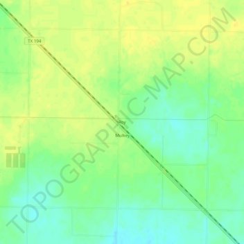
Name: Roy topographic map, elevation, terrain.

Location: Roy, Castro County, Texas, United States (34.44646 -102.23380 34.48646 -102.19380)

Average elevation: 1,147 m

Minimum elevation: 1,134 m

Maximum elevation: 1,156 m

Other topographic maps

Click on a map to view its topography, its elevation and its terrain.

Nazareth

United States > Texas > Castro County

Average elevation: 1,142 m

Dimmitt

United States > Texas > Castro County

Average elevation: 1,171 m

Hart

United States > Texas > Castro County

Average elevation: 1,117 m

Nazareth

United States > Texas > Castro County

Average elevation: 1,142 m

Sheffy Park

United States > Texas > Castro County > Dimmitt

Average elevation: 1,181 m

Hart

United States > Texas > Castro County > Hart

Average elevation: 1,117 m

Gear up for your next adventure:

🦟Insect Repellent - Keep mosquitoes and black flies away in wooded areas
🔥Camping Stove - Portable stoves to cook outdoors with ease
🔦UV Flashlight - Detect minerals or specific insects in the dark
🧥Waterproof Jacket - Lightweight rain jackets for hiking and outdoor activities
🥾Lightweight Hiking Boots - Boots for comfort and mobility on long hikes

As an Amazon Associate, this site earns from qualifying purchases at no extra cost to you.