Geolocate

Fronteras topographic map

Click on the map to display elevation.

About this map

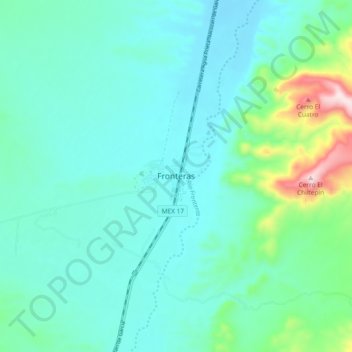
Name: Fronteras topographic map, elevation, terrain.

Location: Fronteras, Sonora, Mexico (30.85635 -109.59946 30.93635 -109.51946)

Average elevation: 1,191 m

Minimum elevation: 1,111 m

Maximum elevation: 1,561 m

Gear up for your next adventure:

🧳Compression Sacks - Maximize space in your backpack by shrinking gear
🧼Biodegradable Camp Soap - Environmentally friendly cleaning for gear and body
Camping Coffee Maker - Brew fresh coffee anywhere on the topographic map
Backpacking Tent - Lightweight tent for long-distance hiking trips
🛰️Satellite Messenger - Emergency communication for areas with no cell service

As an Amazon Associate, this site earns from qualifying purchases at no extra cost to you.