
Ardabil topographic map
Click on the map to display elevation.
Ardabil
Ardabil is located on the Baliqly Chay River, about 70 km (43 mi) from the Caspian Sea(Khazar), and 210 km (130 mi) from the city of Tabriz. It has an average altitude of 1,263 metres (4,144 ft) and total area of 18.011 km2 (6.954 sq mi). Neighboring on the Caspian Sea. It has been of great political and economic significance throughout history, especially within the Caucasus region. It is located on an open plain 1,500 metres (4,900 ft) above sea level, just east of Mount Sabalan (4,811 m), where cold spells occur until late spring.
About this map
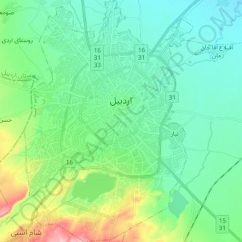
Name: Ardabil topographic map, elevation, terrain.
Location: Ardabil, بخش مرکزی, Ardabil city, Ardabil Province, Iran (38.18891 48.24409 38.29494 48.33783)
Average elevation: 1,358 m
Minimum elevation: 1,321 m
Maximum elevation: 1,476 m
Other topographic maps
Click on a map to view its topography, its elevation and its terrain.