
Thank you for supporting this site ❤️
Make a donation
Make a donation
Gear up for your next adventure:
As an Amazon Associate, this site earns from qualifying purchases at no extra cost to you.
Batur topographic map
Click on the map to display elevation.
Thank you for supporting this site ❤️
Make a donation
Make a donation
Gear up for your next adventure:
As an Amazon Associate, this site earns from qualifying purchases at no extra cost to you.
About this map
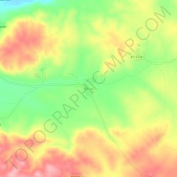
Name: Batur topographic map, elevation, terrain.
Location: Batur, Dicle, Diyarbakır, Güneydoğu Anadolu Bölgesi, Turkije (38.26536 40.24707 38.30536 40.28707)
Average elevation: 813 m
Minimum elevation: 742 m
Maximum elevation: 875 m
Thank you for supporting this site ❤️
Make a donation
Make a donation
Gear up for your next adventure:
As an Amazon Associate, this site earns from qualifying purchases at no extra cost to you.