
Îles Shetland topographic map
Interactive map
Click on the map to display elevation.
About this map
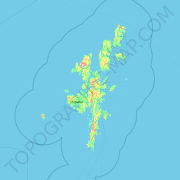
Name: Îles Shetland topographic map, elevation, terrain.
Location: Îles Shetland, Écosse, ZE2 9PY, Royaume-Uni (59.63333 -2.03333 61.03333 -0.63333)
Average elevation: 4 m
Minimum elevation: -2 m
Maximum elevation: 436 m