Geolocate

Prairie Ridge topographic map

Click on the map to display elevation.

About this map

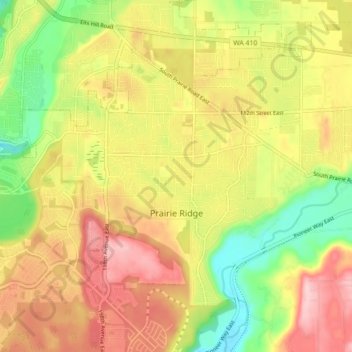
Name: Prairie Ridge topographic map, elevation, terrain.

Location: Prairie Ridge, Pierce County, Washington, United States (47.12038 -122.17422 47.16607 -122.09672)

Average elevation: 197 m

Minimum elevation: 95 m

Maximum elevation: 308 m

Gear up for your next adventure:

🦟Insect Repellent - Keep mosquitoes and black flies away in wooded areas
🛁Quick-Dry Microfiber Towel - Space-saving towel that dries rapidly on the move
🦶Hiking Shoe Insoles - Added support for high arches and long days on feet
🪑Ultralight Camping Stool - Compact seating for rest stops during long hikes
🧥Thermal Layer - Insulating layer for cold outdoor conditions

As an Amazon Associate, this site earns from qualifying purchases at no extra cost to you.