
Thank you for supporting this site ❤️
Make a donation
Make a donation
Gear up for your next adventure:
As an Amazon Associate, this site earns from qualifying purchases at no extra cost to you.
Olo e Canadelo topographic map
Click on the map to display elevation.
Thank you for supporting this site ❤️
Make a donation
Make a donation
Gear up for your next adventure:
As an Amazon Associate, this site earns from qualifying purchases at no extra cost to you.
About this map
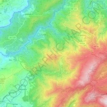
Name: Olo e Canadelo topographic map, elevation, terrain.
Location: Olo e Canadelo, Amarante, Porto, Norte, Portugal (41.28498 -8.02685 41.32999 -7.90764)
Average elevation: 551 m
Minimum elevation: 87 m
Maximum elevation: 1,292 m
Thank you for supporting this site ❤️
Make a donation
Make a donation
Gear up for your next adventure:
As an Amazon Associate, this site earns from qualifying purchases at no extra cost to you.