
Thank you for supporting this site ❤️
Make a donation
Make a donation
Gear up for your next adventure:
As an Amazon Associate, this site earns from qualifying purchases at no extra cost to you.
Huacayo topographic map
Click on the map to display elevation.
Thank you for supporting this site ❤️
Make a donation
Make a donation
Gear up for your next adventure:
As an Amazon Associate, this site earns from qualifying purchases at no extra cost to you.
About this map
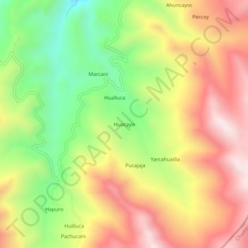
Name: Huacayo topographic map, elevation, terrain.
Location: Huacayo, Haquira, Provincia de Cotabambas, Apurímac, Perú (-14.29976 -72.21298 -14.25976 -72.17298)
Average elevation: 3,958 m
Minimum elevation: 3,573 m
Maximum elevation: 4,325 m
Thank you for supporting this site ❤️
Make a donation
Make a donation
Gear up for your next adventure:
As an Amazon Associate, this site earns from qualifying purchases at no extra cost to you.