
Larbaa N'Ait Irathen District topographic map
Interactive map
Click on the map to display elevation.
About this map
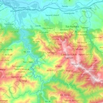
Name: Larbaa N'Ait Irathen District topographic map, elevation, terrain.
Location: Larbaa N'Ait Irathen District, Tizi Ouzou, 15002, Algeria (36.58597 4.10864 36.70201 4.28824)
Average elevation: 408 m
Minimum elevation: 63 m
Maximum elevation: 1,050 m