Geolocate

Mereta topographic map

Click on the map to display elevation.

About this map

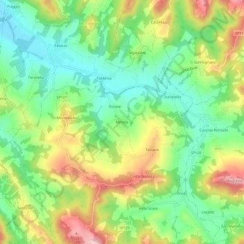
Name: Mereta topographic map, elevation, terrain.

Location: Mereta, Avolasca, Alessandria, Piemonte, Italia (44.80555 8.94987 44.84555 8.98987)

Average elevation: 272 m

Minimum elevation: 176 m

Maximum elevation: 417 m

Gear up for your next adventure:

🥾Lightweight Hiking Shoes - Comfortable shoes for day hikes
🧢Hiking Sun Hat - Wide-brimmed protection for exposed mountain ridges
🥘Camping Cookware Set - Compact nesting pots and pans for trail cooking
💧Hydration Bladder - Hands-free hydration solution for long treks
🔦LED Flashlight - Powerful and long-lasting flashlight for camping and emergencies

As an Amazon Associate, this site earns from qualifying purchases at no extra cost to you.