Geolocate

Guandong topographic map

Click on the map to display elevation.

About this map

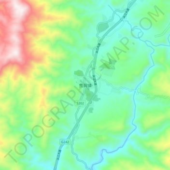
Name: Guandong topographic map, elevation, terrain.

Location: Guandong, Congjiang, Qiandongnan, Guizhou, China (25.80033 109.00007 25.88033 109.08007)

Average elevation: 426 m

Minimum elevation: 170 m

Maximum elevation: 1,019 m

Gear up for your next adventure:

🌡️Emergency Mylar Blankets - Compact thermal protection for unexpected nights outdoors
🧴Insect Repellent - Protect yourself from bugs during outdoor adventures
🥾Mountain Hiking Boots - High-traction boots for rocky terrain
🧤Thermal Hiking Gloves - Grip-enhanced gloves for cold-weather altitude trekking
🥾Hiking Shorts - Breathable shorts suitable for summer hikes

As an Amazon Associate, this site earns from qualifying purchases at no extra cost to you.