Geolocate

Pitino topographic map

Click on the map to display elevation.

About this map

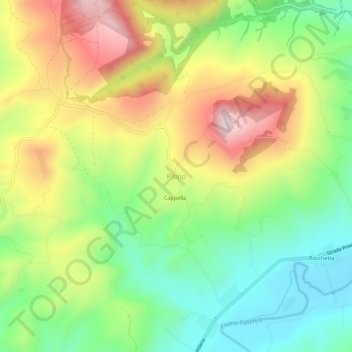
Name: Pitino topographic map, elevation, terrain.

Location: Pitino, San Severino Marche, Macerata, Marche, Italy (43.25383 13.20865 43.29383 13.24865)

Average elevation: 351 m

Minimum elevation: 170 m

Maximum elevation: 594 m

Gear up for your next adventure:

🚲MTB Frame Bag - Carry tools and maps directly on your bicycle frame
🥾Hiking Gaiters - Protect legs and shoes from mud, snow, and debris
🔋Solar Power Bank - Keep your GPS and devices charged during long outdoor trips
👟Leg Gaiters - Keep debris, mud, and snow out of your boots
🧢Outdoor Visor - Breathable visor for sunny hikes

As an Amazon Associate, this site earns from qualifying purchases at no extra cost to you.