Geolocate

Wadi topographic map

Click on the map to display elevation.

About this map

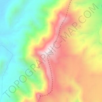
Name: Wadi topographic map, elevation, terrain.

Location: Wadi, Awaran District, Balochistan, Pakistan (26.01394 66.03276 26.01404 66.03286)

Average elevation: 647 m

Minimum elevation: 287 m

Maximum elevation: 1,016 m

Gear up for your next adventure:

🚲Handlebar Phone Mount - View topographic-map.com live while cycling
🎒Hiking Backpack - Lightweight and ergonomic backpacks for day hikes or multi-day treks
🌬️Windproof Camp Stove - Efficient cooking even on exposed mountain peaks
🥾Hiking Shorts - Breathable shorts suitable for summer hikes
🧰Emergency Multi-Tool - Compact multi-tool for outdoor survival

As an Amazon Associate, this site earns from qualifying purchases at no extra cost to you.